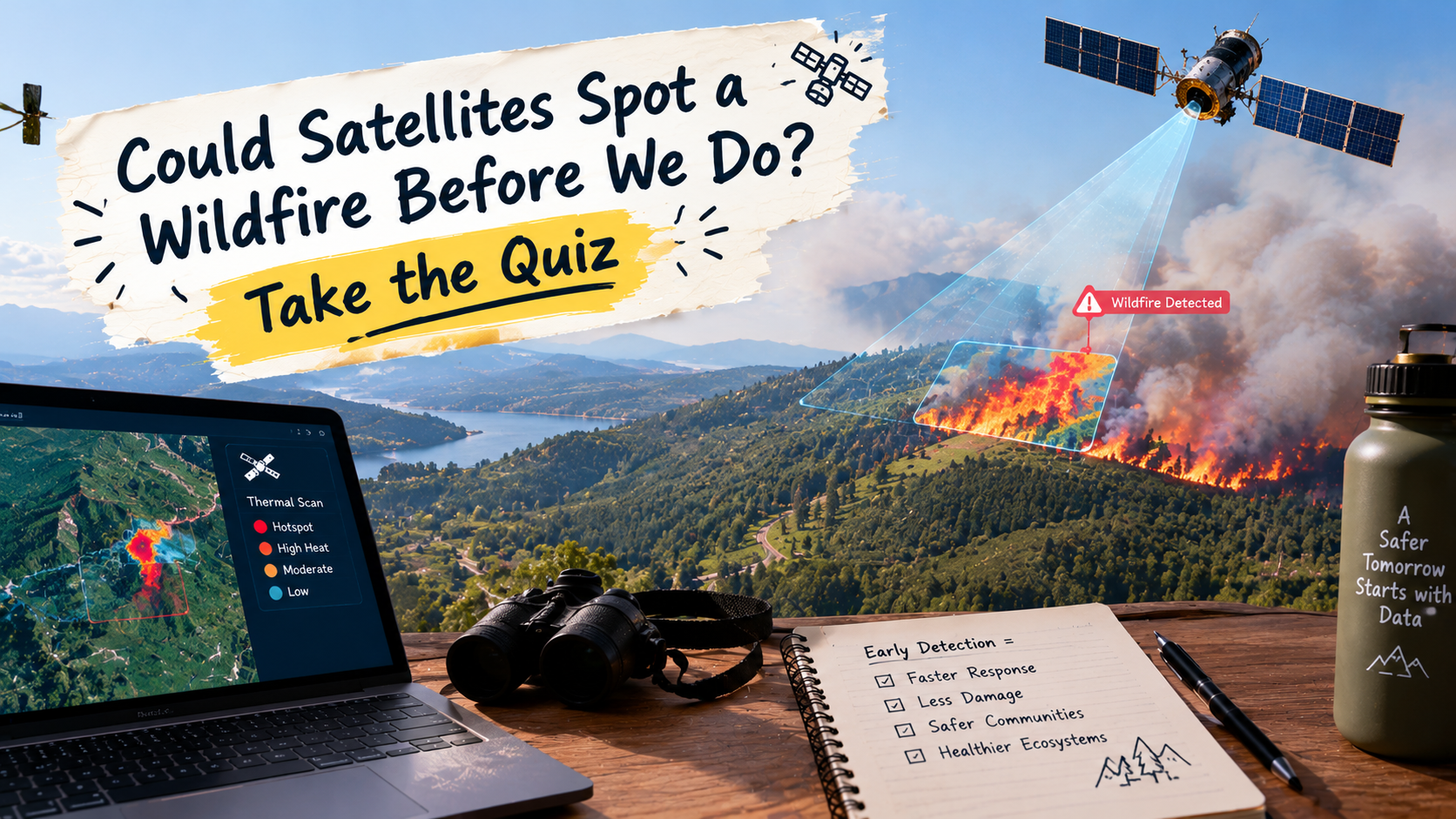
Could Satellites Spot a Wildfire Before We Do? Take the Quiz
Could Satellites Spot a Wildfire Before We Do? Take the Quiz
A fire can start in a remote forest, spread across dry grassland or send smoke drifting hundreds of kilometres from where it began. For people on the ground, getting a clear picture of what is happening can be difficult. From space, however, satellites can help reveal the bigger picture.
Earth-observation satellites collect information about our planet using cameras, heat-sensitive instruments and other sensors. That information can help scientists and emergency teams detect active fires, follow smoke, study vegetation and understand how a fire changes a landscape.
The technology is becoming increasingly useful. New satellite projects are exploring faster wildfire detection, while researchers combine satellite observations with weather information and computer analysis to understand fire risks.
But satellites do not magically prevent fires, and not every satellite can detect every small blaze. Their usefulness depends on the instruments, viewing conditions, data processing and how quickly the information reaches the people who need it.
Ready to see how much you know? Try these 50 questions about satellites, wildfire detection, remote sensing and the science of observing Earth from space. Each answer includes a short explanation, so you can learn something even when you get one wrong.
Watch: How NASA Satellites Help Track Wildfires
This NASA Goddard video shows how satellite observations help scientists monitor fires and understand how smoke moves across the landscape.
Satellite Wildfire Quiz: 50 Questions
1. What is the main purpose of an Earth-observation satellite?
A. To observe and collect information about Earth
B. To transport firefighters between cities
C. To extinguish fires from orbit
D. To replace every weather station
Answer: A. To observe and collect information about Earth.
Earth-observation satellites gather data about land, oceans, atmosphere and environmental changes.
2. What does the term “remote sensing” mean?
A. Measuring something only by touching it
B. Collecting information about an object or area without direct physical contact
C. Repairing equipment from a distance
D. Sending people to a remote location
Answer: B. Collecting information without direct physical contact.
Satellites use sensors to collect information about Earth's surface and atmosphere from a distance.
3. Which instrument can help satellites identify unusually hot areas associated with active fires?
A. A microphone
B. A magnetic compass
C. A thermal sensor
D. A barometer on the ground
Answer: C. A thermal sensor.
Thermal sensors measure emitted energy related to temperature and can help identify fire hotspots.
4. Why might a satellite detect a fire that people on the ground have not reported yet?
A. It can observe large or remote areas from above
B. It automatically sends firefighters to every forest
C. It prevents smoke from forming
D. It can see through every building and every cloud
Answer: A. It can observe large or remote areas from above.
Satellite coverage can reveal activity in places that are difficult to reach or monitor continuously from the ground.
5. What is a wildfire hotspot in satellite data?
A. A place where mobile phones receive stronger signals
B. A location identified as unusually warm or consistent with active burning
C. A permanent station that stores firefighting equipment
D. A place where a satellite charges its battery
Answer: B. A location identified as unusually warm or consistent with active burning.
A hotspot is a detection that may indicate fire activity. It still needs interpretation because other heat sources and observation conditions can affect results.
6. What does a satellite's spatial resolution describe?
A. How long the satellite stays in orbit
B. How much electricity it uses
C. How frequently it sends emails
D. The level of spatial detail represented in its observations
Answer: D. The level of spatial detail represented in its observations.
Spatial resolution affects how small a feature can be distinguished in an image or measurement.
7. Why can a very small fire be difficult for a satellite to detect?
A. Every satellite is designed only for oceans
B. Small fires never release heat
C. The fire may be smaller than the sensor can reliably distinguish
D. Satellites cannot observe land
Answer: C. The fire may be smaller than the sensor can reliably distinguish.
Detection depends partly on pixel size, sensor sensitivity, contrast and the conditions during observation.
8. What is a satellite's revisit time?
A. The time it takes to manufacture a satellite
B. The interval before a satellite or satellite system observes the same area again
C. The time needed to put out a wildfire
D. The length of a satellite's warranty
Answer: B. The interval before a satellite or satellite system observes the same area again.
Shorter revisit intervals can provide more frequent updates, although coverage depends on the orbit and instrument.
9. Why are multiple satellites sometimes used together for wildfire monitoring?
A. They can improve observation frequency and provide different kinds of data
B. They make forests impossible to burn
C. They eliminate the need to interpret data
D. They all take exactly the same image at the same moment
Answer: A. They can improve observation frequency and provide different kinds of data.
Different satellites can complement one another with different viewing times, resolutions and sensor capabilities.
10. What is one reason a satellite image might not show the ground clearly?
A. Trees stop all satellites from orbiting
B. Earth has no reflected sunlight
C. Clouds or smoke can interfere with some observations
D. Satellite images cannot include land
Answer: C. Clouds or smoke can interfere with some observations.
Optical sensors may be blocked or obscured by clouds, haze and smoke. Other sensor types can help in some conditions.
11. What is a major difference between optical and thermal satellite observations?
A. Optical sensors only work underground
B. Thermal sensors only photograph oceans
C. Optical sensors measure sound, while thermal sensors measure wind direction
D. Optical sensors commonly record reflected light, while thermal sensors measure emitted radiation related to temperature
Answer: D. Optical sensors commonly record reflected light, while thermal sensors measure emitted radiation related to temperature.
The two types of observations provide different information and can be useful for different wildfire-monitoring tasks.
12. What does a smoke plume mean?
A. A satellite's exhaust trail
B. A mass of smoke spreading through the air from a source
C. A line drawn on a paper map
D. A cloud that always contains no pollution
Answer: B. A mass of smoke spreading through the air from a source.
Tracking a smoke plume helps researchers understand where smoke is moving and which areas may be affected.
13. What can satellite observations of smoke help scientists investigate?
A. The movement and spread of smoke through the atmosphere
B. The exact thoughts of people near a fire
C. The brand of every vehicle in a forest
D. The age of every tree with perfect certainty
Answer: A. The movement and spread of smoke through the atmosphere.
Satellite observations, combined with atmospheric data, can help scientists study smoke transport and its potential effects on air quality.
14. Which weather condition can encourage a wildfire to spread rapidly?
A. Calm winds in every situation
B. Wet vegetation everywhere
C. Strong winds that carry heat, embers or flames into new areas
D. The absence of combustible material
Answer: C. Strong winds that carry heat, embers or flames into new areas.
Wind can push a fire forward and carry burning embers beyond the main fire front.
15. Why is dry vegetation important in wildfire risk assessment?
A. It makes all fires immediately visible from space
B. It can provide fuel that ignites and burns more readily
C. It prevents heat from reaching the ground
D. It stops the wind from blowing
Answer: B. It can provide fuel that ignites and burns more readily.
Dry grasses, leaves, branches and other plant material can help a fire start and spread when ignition and weather conditions are suitable.
16. What is the main role of satellite data in an emergency response?
A. To guarantee that no one is injured
B. To replace all local knowledge
C. To extinguish the fire remotely in every case
D. To provide information that can support assessment and decision-making
Answer: D. To provide information that can support assessment and decision-making.
Satellite data can help teams understand fire locations, affected areas and changing conditions, but people still need to interpret and act on the information.
17. What does “near-real-time data” usually mean?
A. Information made available relatively soon after observation, with some processing or transmission delay
B. Information collected only a century ago
C. Data that is always perfectly instantaneous
D. Information that cannot be used for decisions
Answer: A. Information made available relatively soon after observation, with some processing or transmission delay.
Near-real-time systems aim to reduce delays, but observation, transmission, processing and distribution still take time.
18. What is one limitation of relying on a single satellite image?
A. It always contains every detail of a fire
B. It can show the future with certainty
C. It captures conditions at a particular observation time and may miss later changes
D. It cannot contain information about land
Answer: C. It captures conditions at a particular observation time and may miss later changes.
Wildfires can change quickly, so repeated observations and information from other sources are valuable.
19. What is a satellite constellation?
A. A group of stars visible only during a fire
B. A group of satellites working as part of a coordinated system
C. A network of fire stations on the ground
D. A type of cloud formation
Answer: B. A group of satellites working as part of a coordinated system.
A constellation can be designed to improve coverage or observation frequency across a large area.
20. What is FireSat designed to help with?
A. Predicting the exact date of every storm
B. Replacing all forest rangers
C. Delivering water directly from orbit
D. Detecting and monitoring wildfires using a purpose-built satellite system
Answer: D. Detecting and monitoring wildfires using a purpose-built satellite system.
FireSat is an initiative focused on improving wildfire observation and building a more useful dataset for fire detection and analysis.
21. Why might artificial intelligence be used with satellite wildfire data?
A. To help identify patterns, flag possible fires or analyse large amounts of imagery
B. To make satellite images unnecessary
C. To ensure every alert is correct without checking
D. To change a satellite's orbit using a text prompt
Answer: A. To help identify patterns, flag possible fires or analyse large amounts of imagery.
AI can help process large datasets quickly, but its results can contain errors and should be evaluated.
22. What is a false alarm in wildfire detection?
A. A fire that has been extinguished
B. A correct report of an active fire
C. An alert that identifies a fire where no fire is actually present
D. A weather forecast that includes rain
Answer: C. An alert that identifies a fire where no fire is actually present.
False alarms can occur when heat sources or unusual surface conditions resemble a fire signal.
23. Why do wildfire monitoring systems need validation?
A. To make every satellite travel faster
B. To check how reliably their detections and estimates match real conditions
C. To ensure that every forest has the same temperature
D. To remove the need for ground observations
Answer: B. To check how reliably their detections and estimates match real conditions.
Validation helps reveal missed fires, false alarms and limitations in a monitoring method.
24. What is ground truth in remote sensing?
A. A drawing of Earth made from memory
B. A satellite orbit calculated without measurements
C. A forecast about what may happen next year
D. Measurements or observations from the ground used to check remote-sensing results
Answer: D. Measurements or observations from the ground used to check remote-sensing results.
Ground observations can help confirm what a satellite signal represents and how accurate an interpretation is.
25. What does a burned-area map show?
A. The area affected by burning, often mapped after or during a fire event
B. The exact location of every firefighter
C. Every place that will burn in the future
D. The depth of every underground water source
Answer: A. The area affected by burning, often mapped after or during a fire event.
Burned-area maps help researchers assess the extent of damage and study how landscapes change after fires.
26. Why can vegetation maps be useful before a wildfire starts?
A. They prove that vegetation cannot catch fire
B. They identify every future ignition with certainty
C. They help describe vegetation types and conditions that may influence fire behaviour
D. They show the names of every person in a forest
Answer: C. They help describe vegetation types and conditions that may influence fire behaviour.
Vegetation and fuel information can contribute to risk assessments when combined with weather, terrain and other data.
27. What is a vegetation index often used to estimate from satellite observations?
A. The number of vehicles on a road with perfect accuracy
B. Aspects of vegetation greenness or condition
C. The exact age of every plant
D. The number of people watching a video
Answer: B. Aspects of vegetation greenness or condition.
Vegetation indices use measurements from selected wavelengths to estimate features related to plant cover and condition.
28. What is one way drought can influence wildfire risk?
A. It makes every plant fireproof
B. It guarantees that no wind will occur
C. It prevents vegetation from drying out
D. It can reduce moisture in vegetation and soils, making some landscapes more fire-prone
Answer: D. It can reduce moisture in vegetation and soils, making some landscapes more fire-prone.
Drought can dry out potential fuel. The actual risk still depends on ignition, vegetation, wind, humidity and other conditions.
29. What is an orbit?
A. The path an object follows around another object under gravity
B. The colour pattern in a satellite image
C. A map of burned trees
D. A type of fire extinguisher
Answer: A. The path an object follows around another object under gravity.
Satellite orbit affects which places it can observe and how often it returns to a particular area.
30. What is one advantage of a geostationary satellite for observing weather and large-scale events?
A. It can land beside a fire whenever it wants
B. It sees every point on Earth in equal detail
C. It can continuously view much of the same region from a fixed apparent position
D. It does not need power or instruments
Answer: C. It can continuously view much of the same region from a fixed apparent position.
Geostationary satellites are useful for frequent observations of the same broad region, though their distance can limit fine spatial detail.
31. What is one advantage of a low Earth orbit satellite?
A. It can remain over one city permanently without moving
B. Its relatively low altitude can support detailed observations, depending on its sensor
C. It can never be affected by clouds
D. It can observe every location continuously from the same position
Answer: B. Its relatively low altitude can support detailed observations, depending on its sensor.
Many Earth-imaging satellites use low Earth orbits to collect detailed data while moving around the planet.
32. Why is infrared information useful in environmental monitoring?
A. It measures the sound of trees falling
B. It shows the exact thoughts of animals
C. It removes all cloud cover from the atmosphere
D. It can reveal information about heat or vegetation that may not be obvious in visible light
Answer: D. It can reveal information about heat or vegetation that may not be obvious in visible light.
Different infrared wavelengths provide different kinds of information, including thermal signals and vegetation characteristics.
33. Can a satellite always detect a fire through thick cloud using an ordinary visible-light camera?
A. No. Thick cloud can block the visible-light view of the ground
B. Yes, because visible light passes through every cloud
C. Yes, if the fire is in a forest
D. No, because visible-light cameras cannot observe land at all
Answer: A. No. Thick cloud can block the visible-light view of the ground.
Cloud cover is a significant limitation for optical observations. Some radar systems can collect useful data through clouds, though radar does not work like a thermal fire detector.
34. What is synthetic aperture radar, commonly called SAR?
A. A camera that only takes photographs at sunset
B. A system that measures only the sound of rain
C. A radar imaging technique that uses a moving platform to create detailed observations
D. A ground-based water pump
Answer: C. A radar imaging technique that uses a moving platform to create detailed observations.
SAR uses radar signals and processing techniques to create images. It is useful in many conditions where optical imagery is limited, although it measures different properties.
35. What is one way satellites help monitor deforestation?
A. They plant trees automatically from orbit
B. They compare observations over time to identify changes in forest cover
C. They prevent every tree from being cut down
D. They count every leaf in every forest
Answer: B. They compare observations over time to identify changes in forest cover.
Repeated satellite observations can reveal forest loss and other changes across large or remote regions.
36. Why might satellite data be combined with weather forecasts?
A. To make the weather identical everywhere
B. To remove all uncertainty from forecasts
C. To replace all measurements of vegetation
D. To better assess how wind, heat, humidity and dry conditions may affect fire behaviour
Answer: D. To better assess how wind, heat, humidity and dry conditions may affect fire behaviour.
Combining observations with weather information can improve situational awareness, though it cannot predict every fire's exact path.
37. What does an atmospheric aerosol refer to?
A. Tiny solid particles or liquid droplets suspended in the air
B. A type of satellite antenna only
C. A tool used to cut trees
D. A map of underground roads
Answer: A. Tiny solid particles or liquid droplets suspended in the air.
Smoke contains particles and gases. Satellite instruments can help scientists study some of the particles and related atmospheric conditions.
38. What can smoke from a wildfire do to air quality?
A. It always makes the air healthier
B. It removes all airborne particles
C. It can add harmful particles and gases to the air
D. It only affects the area directly touching the flames
Answer: C. It can add harmful particles and gases to the air.
Smoke can travel far from a fire and affect communities that are not close to the flames.
39. What does “data latency” mean in a satellite monitoring system?
A. The number of trees visible in an image
B. The delay between data collection and its availability for use
C. The temperature of a forest floor
D. The distance between two fire stations
Answer: B. The delay between data collection and its availability for use.
Lower latency can make information more useful for time-sensitive decisions, although the value of the data also depends on its accuracy and relevance.
40. Why is a map showing the fire's perimeter useful?
A. It guarantees the fire cannot spread beyond the line
B. It shows where every future lightning strike will occur
C. It replaces all emergency communication
D. It helps teams understand the estimated boundary of the fire and monitor changes
Answer: D. It helps teams understand the estimated boundary of the fire and monitor changes.
A perimeter map supports planning and tracking, but the boundary can change quickly and may be uncertain in some areas.
41. What is one limitation of using satellite data to estimate fire damage?
A. Some effects may be difficult to distinguish without additional observations or ground checks
B. Satellites can only observe stars
C. Fire damage never changes the appearance of land
D. Satellites cannot collect repeated observations
Answer: A. Some effects may be difficult to distinguish without additional observations or ground checks.
Satellite measurements are valuable, but field observations and other data may be needed to interpret the full impact.
42. What is the purpose of a satellite data archive?
A. To store only satellite launch photographs
B. To prevent scientists from comparing different years
C. To keep collected data available for later analysis and comparison
D. To replace every current observation with an old one
Answer: C. To keep collected data available for later analysis and comparison.
Archived observations help researchers study long-term changes, past fires and patterns across seasons or years.
43. How can satellite observations help after a wildfire?
A. By guaranteeing that all vegetation immediately grows back
B. By helping map burned areas and monitor landscape recovery over time
C. By reversing the fire's effects instantly
D. By identifying every person who entered the forest
Answer: B. By helping map burned areas and monitor landscape recovery over time.
Repeated observations can help researchers track changes in vegetation and land cover after a fire.
44. What is a key reason to make wildfire satellite data accessible to emergency agencies?
A. To ensure no human decision is needed
B. To keep observations hidden from responders
C. To guarantee every fire is detected at ignition
D. To help responders use relevant information when planning and prioritising their work
Answer: D. To help responders use relevant information when planning and prioritising their work.
Data is most useful when it reaches the people who can interpret it and apply it to real decisions.
45. Which statement about satellite wildfire detection is most accurate?
A. It can help identify and monitor some fires, but detection is not perfect
B. It detects every fire at the exact moment of ignition
C. It works equally well with every sensor in every weather condition
D. It makes local fire services unnecessary
Answer: A. It can help identify and monitor some fires, but detection is not perfect.
Satellite monitoring is powerful, but small fires, clouds, observation gaps and sensor limitations can affect detection.
46. What does multispectral imaging involve?
A. Recording only one sound frequency
B. Taking images only at night
C. Collecting observations in multiple wavelength bands
D. Photographing the same object using only one colour filter forever
Answer: C. Collecting observations in multiple wavelength bands.
Different wavelength bands can reveal features that are difficult to distinguish using a single band alone.
47. Why can satellite images taken on different dates be useful together?
A. They always show identical conditions
B. They can reveal changes in a fire, vegetation or landscape over time
C. They remove the need for a date or location
D. They guarantee that all changes were caused by fire
Answer: B. They can reveal changes in a fire, vegetation or landscape over time.
Comparing dates helps identify change, although analysts still need to consider other possible causes and differences in viewing conditions.
48. What is one important role for human experts in AI-assisted satellite monitoring?
A. To ignore every alert from the system
B. To assume the AI cannot make mistakes
C. To avoid checking uncertain detections
D. To interpret results, verify important alerts and make decisions using wider context
Answer: D. To interpret results, verify important alerts and make decisions using wider context.
AI can help analyse data, while human judgement and reliable procedures remain important for high-impact decisions.
49. What is the best way to understand a satellite fire alert?
A. As a signal that may require checking alongside other information
B. As proof that the entire region is burning
C. As a guarantee that a fire will stop spreading
D. As a replacement for every emergency report
Answer: A. As a signal that may require checking alongside other information.
Alerts help direct attention, but location, confidence, weather, ground reports and other evidence matter when interpreting them.
50. What is the biggest advantage of observing wildfires from space?
A. Satellites can put out every fire without assistance
B. Satellites remove all environmental risks
C. They provide a broad view that can support detection, monitoring and informed response
D. They guarantee that wildfires will never happen again
Answer: C. They provide a broad view that can support detection, monitoring and informed response.
Satellite observations help connect information across large areas and over time, giving scientists and responders a wider view of changing conditions.
How Did You Score?
Count your correct answers and see how you did.
- 45–50: Satellite expert in the making. You understand how space-based observations help us monitor our planet.
- 35–44: Great result. You know the main ideas behind wildfire detection and Earth observation.
- 25–34: A solid start. You understand the basics, with a few new concepts to explore.
- 15–24: There is plenty more to discover about how satellites collect and interpret information.
- 0–14: No worries. Now you have a starting point for learning how we observe Earth from space.
Final Thoughts
Satellites cannot stop every wildfire, and they do not provide a perfect picture of every fire. What they can do is help us see more of what is happening across large and sometimes inaccessible areas.
By combining satellite observations with weather data, ground reports and careful analysis, researchers and emergency teams can build a clearer understanding of fire activity, smoke movement and the effects on the landscape.
That is what makes Earth observation so interesting: the technology is not just about taking pictures from space. It is about turning those observations into useful information here on the ground.
How many questions did you get right? Share your score and challenge someone else to take the quiz.