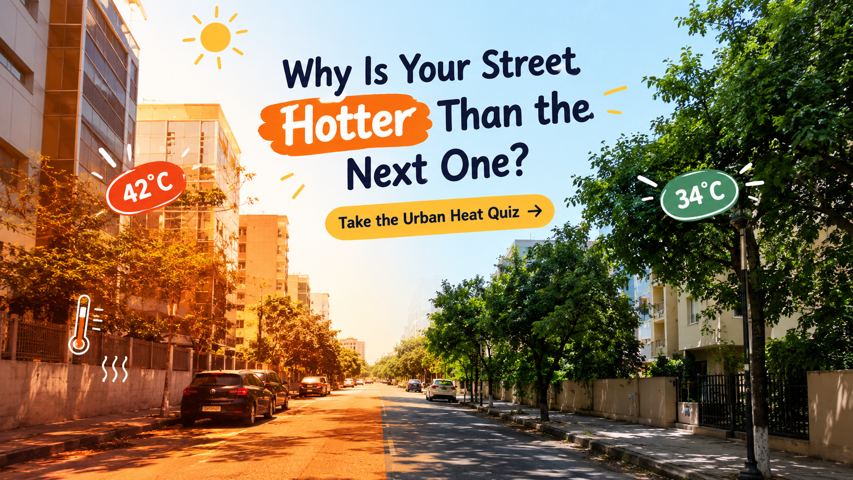
Why Is Your Street Hotter Than the Next One? Take the Urban Heat Quiz
Why Is Your Street Hotter Than the Next One? Take the Urban Heat Quiz
Have you ever walked down a shaded street and then turned a corner into a stretch of road that suddenly feels much hotter? It is easy to blame the weather, but the design of a neighbourhood can make a real difference.
Dark roads, concrete walls, closely packed buildings, limited tree cover and traffic can all influence how heat builds up in a city. Some places absorb and hold more heat than others, which is one reason urban temperatures can vary from street to street.
Researchers study these differences using weather stations, portable sensors, satellite observations and even measurements collected by local residents. The aim is not simply to produce colourful temperature maps. Better information can help cities decide where shade, trees, cooler surfaces and other improvements may be most useful.
In this quiz, you will explore the urban heat island effect, how surfaces behave in sunlight, why nights can remain warm, and how scientists measure heat. You do not need to be a climate expert to take part. Just choose your answer before reading the explanation.
Watch: How Satellites Help Map Urban Heat
NASA's Applied Remote Sensing Training Program explains how satellite remote sensing can be used to study urban heat islands and land surface temperature.
Urban Heat Quiz: 50 Questions
1. What is an urban heat island?
A. A city area that is warmer than its surrounding rural areas
B. An island built in the middle of a city lake
C. A city with no winter season
D. A place where every building uses air conditioning
Answer: A. A city area that is warmer than its surrounding rural areas.
Urban heat islands occur when built-up areas experience higher temperatures than nearby less-developed areas. The size of the difference varies with weather, location and city design.
2. Which surface commonly absorbs and stores a lot of solar energy?
A. A shaded pond
B. A dark asphalt road
C. A leafy tree canopy
D. A light-coloured reflective roof
Answer: B. A dark asphalt road.
Dark asphalt often absorbs substantial sunlight and can become much hotter than shaded or more reflective surfaces.
3. Why can a city remain warm after sunset?
A. The Sun continues shining on every street
B. Concrete creates sunlight at night
C. Buildings and paved surfaces release heat stored during the day
D. The air stops moving after dark everywhere
Answer: C. Buildings and paved surfaces release heat stored during the day.
Materials can store energy and release it gradually. This can keep some urban areas warmer well into the night.
4. What is one important way trees help cool a neighbourhood?
A. They stop Earth's gravity
B. They remove all humidity from the air
C. They prevent all sunlight from reaching the city
D. Their shade blocks sunlight, while water released by leaves can cool the surrounding air
Answer: D. Their shade blocks sunlight, while water released by leaves can cool the surrounding air.
Trees provide shade and release water vapour through transpiration. Both processes can reduce heat exposure, although the effect depends on local conditions.
5. What does albedo describe?
A. The fraction of incoming sunlight a surface reflects
B. The speed of wind between buildings
C. The amount of rain a city receives in a year
D. The number of vehicles using a road
Answer: A. The fraction of incoming sunlight a surface reflects.
Surfaces with higher albedo reflect more incoming solar radiation, while surfaces with lower albedo absorb more, all else being equal.
6. Which change is most likely to reduce direct sunlight on a pedestrian pavement?
A. Removing nearby trees
B. Adding shade from trees or a suitable canopy
C. Replacing a footpath with dark asphalt
D. Removing covered walkways
Answer: B. Adding shade from trees or a suitable canopy.
Shade reduces the amount of direct solar energy reaching people and the pavement, making the walking environment more comfortable.
7. What is land surface temperature?
A. The temperature inside every building
B. The temperature of an underground railway
C. The temperature of the Earth's surface, such as soil, roofs or roads
D. The average temperature of the entire planet's atmosphere
Answer: C. The temperature of the Earth's surface, such as soil, roofs or roads.
Land surface temperature describes how hot the surface itself is. It is not the same as the air temperature reported by a typical weather station.
8. Can satellite measurements of land surface temperature tell us the exact air temperature a person feels at street level?
A. Yes, in every location and at every time
B. Yes, because surfaces and air always have identical temperatures
C. Only if the city has no trees
D. No. Surface temperature and near-surface air temperature are different measurements
Answer: D. No. Surface temperature and near-surface air temperature are different measurements.
Satellite data provide useful information about heated surfaces, but street-level air temperature and human heat exposure require additional context or measurements.
9. Why might a large parking lot become very hot on a sunny afternoon?
A. It contains broad exposed paved surfaces with little shade
B. Cars permanently block all wind
C. Asphalt produces its own sunlight
D. Parking lots cannot release heat
Answer: A. It contains broad exposed paved surfaces with little shade.
Large exposed surfaces can absorb solar energy, while limited shade leaves people and pavement directly exposed to the Sun.
10. What is one reason densely built neighbourhoods may retain heat?
A. Buildings make sunlight disappear
B. Building materials store heat, and urban geometry can reduce how quickly some areas cool
C. Dense neighbourhoods cannot have wind
D. Buildings prevent all heat from escaping into the atmosphere
Answer: B. Building materials store heat, and urban geometry can reduce how quickly some areas cool.
Materials, street layouts, shading and airflow interact to influence how urban areas warm and cool.
11. Which measurement is commonly used to describe the temperature of the air?
A. The colour of a roof
B. The brightness of a streetlight
C. A thermometer placed in a suitable, shaded and ventilated location
D. The number of trees on a map
Answer: C. A thermometer placed in a suitable, shaded and ventilated location.
Properly positioned and shielded thermometers help measure air temperature without excessive influence from direct sunlight or nearby hot surfaces.
12. Why can a thermometer placed directly in sunlight give a misleading air-temperature reading?
A. Sunlight turns every thermometer into a rain gauge
B. Sunlight always lowers a thermometer's temperature
C. Thermometers can only measure temperature indoors
D. The instrument itself may heat up in the Sun and read higher than the surrounding air
Answer: D. The instrument itself may heat up in the Sun and read higher than the surrounding air.
Air-temperature measurements need suitable shielding and ventilation so the sensor measures the air rather than mainly absorbing direct radiation.
13. What is a heat map?
A. A visual representation showing how a measured value varies across locations
B. A map that only shows roads during winter
C. A drawing of a city's power cables
D. A map that predicts every temperature with perfect accuracy
Answer: A. A visual representation showing how a measured value varies across locations.
Heat maps can show measured or estimated temperature patterns, helping researchers identify places that may need closer attention.
14. What does remote sensing allow researchers to do?
A. Feel the temperature of every road directly
B. Collect information about places from a distance using sensors
C. Change the weather remotely
D. Measure only objects inside a laboratory
Answer: B. Collect information about places from a distance using sensors.
Satellites and aircraft can collect information across wide areas without requiring a researcher to visit every location.
15. Which type of satellite observation is especially useful for estimating land surface temperature?
A. A photograph of city traffic at night with no temperature data
B. A satellite radio message
C. Thermal infrared measurements
D. A map of underground pipes alone
Answer: C. Thermal infrared measurements.
Thermal infrared sensors measure emitted radiation that can be processed to estimate the temperature of Earth's surface.
16. Why do researchers combine satellite observations with ground measurements?
A. To make all neighbourhoods have the same temperature
B. To remove the need for scientific checks
C. To ensure that clouds never affect satellite data
D. To compare different types of measurements and better understand local conditions
Answer: D. To compare different types of measurements and better understand local conditions.
Satellite data show broad surface patterns, while ground measurements help researchers understand local air temperatures and validate estimates.
17. What is a citizen-science project?
A. A project in which members of the public help collect or analyse scientific information
B. A project that allows only professional astronauts to participate
C. A project that avoids collecting any observations
D. A city competition to build the tallest tower
Answer: A. A project in which members of the public help collect or analyse scientific information.
Citizen science can involve volunteers taking measurements, reporting observations or helping researchers investigate local environmental conditions.
18. How might residents help researchers understand street-level heat?
A. By guessing temperatures without any method
B. By collecting temperature readings using suitable sensors and following a consistent procedure
C. By measuring only indoor refrigerator temperatures
D. By recording the colour of every passing car
Answer: B. By collecting temperature readings using suitable sensors and following a consistent procedure.
Consistent measurements taken at documented locations and times can add useful local detail to environmental studies.
19. What is one challenge when comparing temperature readings from different low-cost sensors?
A. Every sensor measures exactly the same value by definition
B. Sensors cannot measure temperature outdoors
C. Sensors may differ in accuracy, calibration and exposure to sunlight
D. Temperature readings do not need a location or time
Answer: C. Sensors may differ in accuracy, calibration and exposure to sunlight.
Calibration, placement and consistent methods are important for making measurements comparable.
20. What does sensor calibration help establish?
A. The colour of a sensor's case
B. The number of streets in a city
C. The age of every nearby building
D. How a sensor's readings compare with a trusted reference
Answer: D. How a sensor's readings compare with a trusted reference.
Calibration helps identify measurement offsets or errors and improves confidence in the data.
21. Which surface is generally more reflective of sunlight?
A. A light-coloured roof designed to reflect solar radiation
B. A very dark asphalt surface
C. A black rubber mat
D. A dark, unshaded road
Answer: A. A light-coloured roof designed to reflect solar radiation.
Reflective roofs can reduce solar energy absorbed by a building's roof, although performance depends on the material and its condition.
22. What is a cool roof designed to do?
A. Keep rainwater permanently frozen
B. Reflect more sunlight and often release absorbed heat more effectively than conventional roofing
C. Make a building warmer during every season
D. Replace the need for any building ventilation
Answer: B. Reflect more sunlight and often release absorbed heat more effectively than conventional roofing.
Cool roofs can lower roof surface temperatures and may reduce indoor cooling demand, depending on the building and climate.
23. What is one possible benefit of permeable pavement?
A. It prevents every form of urban flooding
B. It always stays colder than water
C. It allows water to pass through into an underlying layer, where suitable design can support drainage and moisture retention
D. It prevents all sunlight from reaching a road
Answer: C. It allows water to pass through into an underlying layer, where suitable design can support drainage and moisture retention.
Permeable pavement can help manage runoff. Its cooling effect depends on design, water availability, material and local conditions.
24. Why can evaporating water cool a surface?
A. Evaporation creates cold air from nothing
B. Water prevents all energy from moving
C. Evaporation increases the surface's sunlight absorption in every case
D. Evaporation uses energy, drawing heat from the surrounding surface and environment
Answer: D. Evaporation uses energy, drawing heat from the surrounding surface and environment.
Evaporative cooling transfers energy as liquid water changes into vapour. The amount of cooling depends on humidity, water availability and other conditions.
25. What is transpiration in plants?
A. The release of water vapour from plant leaves and other above-ground parts
B. The movement of vehicles through a forest
C. The reflection of sunlight by a roof
D. The process of concrete becoming warmer
Answer: A. The release of water vapour from plant leaves and other above-ground parts.
Transpiration is part of the water cycle and can contribute to cooling around vegetation when water is available.
26. Why can a shaded pavement feel cooler than a sunlit pavement even when both are in the same neighbourhood?
A. Shade changes the distance between Earth and the Sun
B. The shaded pavement receives less direct solar energy
C. Sunlit pavements cannot release heat
D. Shade removes all humidity from the air
Answer: B. The shaded pavement receives less direct solar energy.
Reducing direct sunlight often lowers the surface temperature and can reduce radiant heat exposure for pedestrians.
27. What is mean radiant temperature relevant to?
A. The average age of buildings around a road
B. The temperature inside a satellite
C. The combined effect of radiant heat received by a person from surrounding surfaces and the environment
D. The number of hours of daylight in a year
Answer: C. The combined effect of radiant heat received by a person from surrounding surfaces and the environment.
Radiant heat from the Sun, walls, roads and other surroundings can strongly influence how hot a person feels outdoors.
28. Why can two places with the same air temperature feel different to a person?
A. Air temperature is never relevant to comfort
B. Human bodies cannot sense heat
C. Every surface has the same temperature as the air
D. Shade, humidity, wind, clothing and radiant heat can affect how hot a person feels
Answer: D. Shade, humidity, wind, clothing and radiant heat can affect how hot a person feels.
Human heat stress depends on several factors, not just the air temperature shown by a thermometer.
29. What does the term “urban canopy layer” usually refer to?
A. The air layer from near the ground up to around roof level, influenced by streets and buildings
B. A layer of clouds that always covers a city
C. A plastic cover placed over every road
D. The region of space above all satellites
Answer: A. The air layer from near the ground up to around roof level, influenced by streets and buildings.
This layer is where people experience much of the local urban environment, and its temperature can be affected by street layout and building materials.
30. What is a common cause of higher heat exposure in a treeless street?
A. Trees elsewhere automatically cool every street equally
B. People and pavement receive more direct sunlight, with less shade available
C. The street is farther from the Sun
D. The air contains no oxygen
Answer: B. People and pavement receive more direct sunlight, with less shade available.
Tree cover can reduce direct solar exposure, though the benefits vary with canopy size, placement and local conditions.
31. What is one concern when planting trees to reduce urban heat?
A. Trees never need water
B. All tree species grow at the same rate
C. Species, water needs, root space, maintenance and local climate need to be considered
D. Trees cannot provide shade
Answer: C. Species, water needs, root space, maintenance and local climate need to be considered.
Well-planned tree planting can provide long-term shade, but suitable species and maintenance are important for success.
32. Why can narrow streets between tall buildings have complicated temperature patterns?
A. Tall buildings eliminate all forms of radiation
B. Every narrow street is always the hottest place in a city
C. Street width has no influence on sunlight or wind
D. Building height and street orientation affect shade, airflow and how surfaces receive sunlight
Answer: D. Building height and street orientation affect shade, airflow and how surfaces receive sunlight.
Urban geometry can create shaded areas, sunlit areas and different wind patterns. The result varies by time of day and season.
33. What is an urban climate model used for?
A. Representing and studying how buildings, surfaces, vegetation and weather interact in a city
B. Guaranteeing the exact temperature of every future day
C. Replacing all weather observations with guesses
D. Designing only underground tunnels
Answer: A. Representing and studying how buildings, surfaces, vegetation and weather interact in a city.
Models help researchers test scenarios and understand urban climate processes, but their results depend on assumptions and input data.
34. Why do researchers compare urban temperatures at different times of day?
A. Because temperature only exists at noon
B. Because sunlight, stored heat, wind and human activity change throughout the day
C. Because a city cannot cool after sunset
D. Because temperature measurements have no time component
Answer: B. Because sunlight, stored heat, wind and human activity change throughout the day.
Time matters: the hottest surface in the afternoon may behave differently after sunset or before sunrise.
35. What is one reason a satellite might miss the hottest moment on a street?
A. Satellites cannot observe cities
B. Streets do not change temperature
C. The satellite may pass over at a different time from the daily temperature peak
D. All satellite instruments are turned off during summer
Answer: C. The satellite may pass over at a different time from the daily temperature peak.
Satellite observations are snapshots taken at particular times, so they may not capture the daily maximum temperature.
36. Why is cloud cover important when using thermal infrared satellite data?
A. Clouds always make land surface temperatures easier to calculate
B. Clouds make all surface measurements identical
C. Clouds have no effect on thermal observations
D. Clouds can obstruct the view of the surface and complicate temperature estimates
Answer: D. Clouds can obstruct the view of the surface and complicate temperature estimates.
Researchers need to account for cloud cover and other atmospheric effects when interpreting satellite-derived land surface temperatures.
37. What does spatial resolution tell you about a temperature map?
A. How much geographic detail its pixels or grid cells represent
B. How many years the city has existed
C. How often a city council meets
D. The exact number of residents in each building
Answer: A. How much geographic detail its pixels or grid cells represent.
Higher spatial detail can help identify smaller patterns, although the actual accuracy also depends on the sensor and processing method.
38. Why might a city use portable temperature sensors along a walking route?
A. To make every street equally hot
B. To compare local conditions across different places and times
C. To stop the Sun from reaching the pavement
D. To measure the city's population directly
Answer: B. To compare local conditions across different places and times.
Mobile measurements can reveal local variation that may be missed by a small number of fixed weather stations.
39. What is a fixed weather station useful for?
A. Measuring the temperature of every road at once
B. Replacing all satellite observations
C. Recording weather conditions at a consistent location over time
D. Preventing a heatwave from developing
Answer: C. Recording weather conditions at a consistent location over time.
Fixed stations help track changes over time, though their readings may not represent every street in a large city.
40. What does heat vulnerability describe in urban planning?
A. The colour of a city's tallest building
B. The amount of electricity a satellite uses
C. The distance between a city and the equator alone
D. How likely people or places are to experience harm from heat, considering exposure and their ability to cope
Answer: D. How likely people or places are to experience harm from heat, considering exposure and their ability to cope.
Heat vulnerability can depend on age, health, housing, access to cooling, outdoor work, income and other social or environmental factors.
41. Why might older adults and people with certain health conditions face greater risks during extreme heat?
A. Their bodies or circumstances may make it harder to regulate temperature or access protection from heat
B. They always live in hotter cities
C. Heat affects only people who work outdoors
D. They are unable to feel temperature changes at all
Answer: A. Their bodies or circumstances may make it harder to regulate temperature or access protection from heat.
Risk differs between people. Health, medication, housing, social support and access to cooling can all affect how someone copes with extreme heat.
42. What is one purpose of a city heat-action plan?
A. To make summer temperatures rise faster
B. To organise steps such as public warnings, cooling access and support for vulnerable residents
C. To remove every tree from busy streets
D. To replace weather forecasts with street maps
Answer: B. To organise steps such as public warnings, cooling access and support for vulnerable residents.
Heat-action plans help communities prepare for dangerous conditions and coordinate responses before and during heatwaves.
43. How can green roofs contribute to reducing urban heat?
A. They guarantee that a building will never need cooling
B. They create more dark asphalt on rooftops
C. Vegetation and growing media can shade the roof and support cooling through evapotranspiration
D. They stop all rainfall from reaching a city
Answer: C. Vegetation and growing media can shade the roof and support cooling through evapotranspiration.
Green roofs can reduce roof temperatures and provide other benefits, but their performance depends on design, maintenance and water availability.
44. What is one potential benefit of a shaded bus stop?
A. It changes the official time zone
B. It eliminates the need for public transport
C. It guarantees that no one will experience heat stress
D. It reduces direct sunlight exposure for people waiting outdoors
Answer: D. It reduces direct sunlight exposure for people waiting outdoors.
Shade can improve comfort at transit stops, especially when people cannot avoid waiting outside during hot weather.
45. Why should planners consider both daytime and nighttime heat?
A. People can experience heat stress at night too, particularly when buildings and streets remain warm
B. Cities are always cooler than rural areas at night
C. Nighttime temperatures have no effect on health
D. Urban surfaces stop storing heat after sunset
Answer: A. People can experience heat stress at night too, particularly when buildings and streets remain warm.
Warm nights can limit the body's opportunity to recover from daytime heat, especially during prolonged heatwaves.
46. What is one limitation of a citywide average temperature?
A. It cannot be calculated mathematically
B. It may hide hotter and cooler locations within the same city
C. It always tells you the temperature inside each home
D. It shows the exact heat exposure of every resident
Answer: B. It may hide hotter and cooler locations within the same city.
Local maps and measurements can reveal differences between shaded parks, busy roads, dense neighbourhoods and other areas.
47. What is a useful way to evaluate whether a street-cooling project is working?
A. Count how many cars pass the street once
B. Ask only whether the pavement looks attractive
C. Compare appropriate measurements before and after the change while considering weather and other factors
D. Assume the project worked as soon as construction ends
Answer: C. Compare appropriate measurements before and after the change while considering weather and other factors.
Careful evaluation can help separate the project's effects from changes caused by weather, season or other conditions.
48. What is an important limitation of using only satellite data to decide where people need heat protection?
A. Satellites cannot observe any city surfaces
B. Satellite data always show individual health conditions
C. Satellites measure every person's indoor temperature directly
D. Surface temperature alone does not reveal every person's exposure, health risk or access to cooling
Answer: D. Surface temperature alone does not reveal every person's exposure, health risk or access to cooling.
Good planning combines physical temperature information with population, housing, health, shade and other local information.
49. Which combination can provide a more complete picture of urban heat?
A. Satellite observations, ground sensors, weather information and local knowledge
B. A single photograph with no location or date
C. The colour of one building alone
D. A city population estimate with no temperature information
Answer: A. Satellite observations, ground sensors, weather information and local knowledge.
Combining different sources helps researchers understand both broad patterns and the conditions people experience on the ground.
50. What is the most useful lesson from studying urban heat?
A. Every city has exactly the same temperature pattern
B. City design and local conditions can influence heat, and better evidence can guide practical improvements
C. Satellites can eliminate all heatwaves
D. Planting a single tree guarantees that an entire city will cool down
Answer: B. City design and local conditions can influence heat, and better evidence can guide practical improvements.
Urban heat is influenced by surfaces, vegetation, buildings, weather and people's circumstances. Measuring these factors can help cities plan more effectively.
How Did You Score?
Finished all 50 questions? Count your correct answers and see how you did.
- 45–50: Urban heat expert in the making. You understand the science behind hot streets and cooler neighbourhoods.
- 35–44: Great result. You know how city design, vegetation and temperature measurements connect.
- 25–34: A good start. You have the basics and have probably learned a few new facts.
- 15–24: There is more to discover about the way buildings, roads and trees affect local temperatures.
- 0–14: No worries. Now you have a starting point for understanding why one part of a city can feel hotter than another.
Final Thoughts
Urban heat is not just a matter of how hot the weather forecast says it will be. A shaded pavement, a dark parking lot, a leafy street and a closely packed neighbourhood can all respond differently to the same sunshine.
That is why researchers are combining satellite observations, ground sensors and local knowledge to map heat in greater detail. The information can help cities think more carefully about shade, roofs, green spaces, public areas and support for people most at risk.
There is no single solution that works everywhere. But understanding where heat builds up is a useful first step toward making neighbourhoods more comfortable and safer during hot weather.
How many did you get right? Share your score with someone and see whether they can beat it.